Illustrated Map for Belvoir Castle’s Adventure Playground
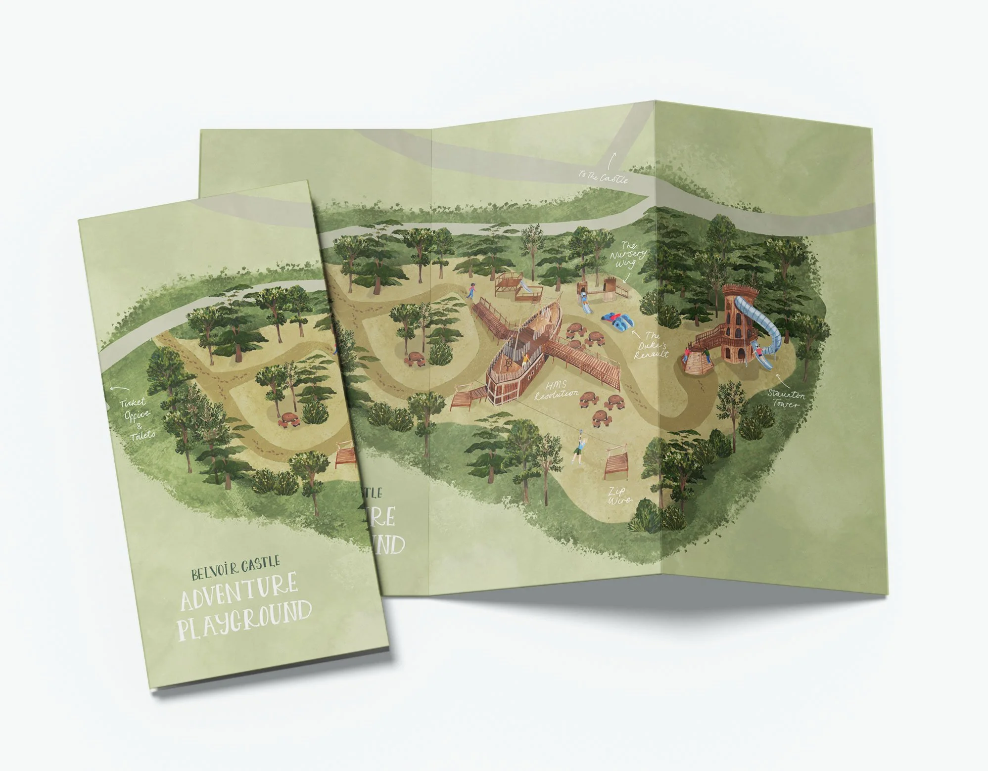
An illustrated map created for Belvoir Castle to show the brand new Adventure Playground. The map will help the parents and children to navigate their way around the extensive play area as well as locate the map within the grounds of the castle.

Map of the Adventure Playground, highlighting the different areas to play in as well as picnic seating and how to access the rest of the grounds.
Illustrated map as a leaflet handout

Also to be used as a large scale sign on site.
All elements were drawn by hand using watercolour, gouache and ink before being digitalised so that the map can be used for a variety of purposes and sizes. The colour palette was chosen to reflect the materials used to build the playground and to give it a natural feel. The map will be used for digital purposes, printed handouts and also for a large sign at the entrance of the playground.
For more information about the playground or to visit the castle, please use the links below: